 |
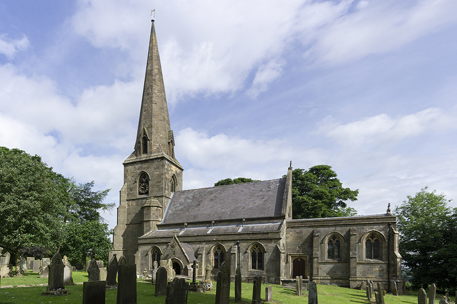
| All Saints, Grindon in June 2018 |
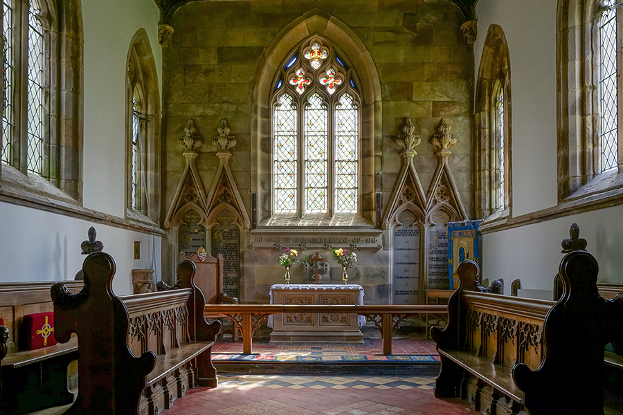 |
| The Chancel, taken with in-camera HDR |
|
| All Saints, Grindon in June 2018 |
|
| The Chancel, taken with in-camera HDR |
 |
 |
|
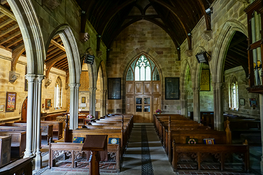
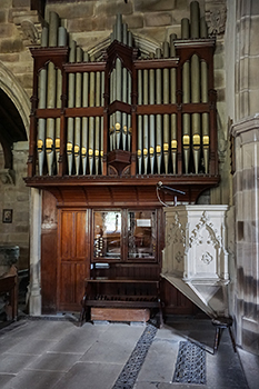
| The Nave and South Aisle | The organ and pulpit | |
 |
 |
|
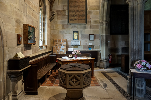
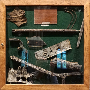
| Font and location of plaques | Plaque made from the wreckage of the Halifax Bomber | |
 |
 |
|
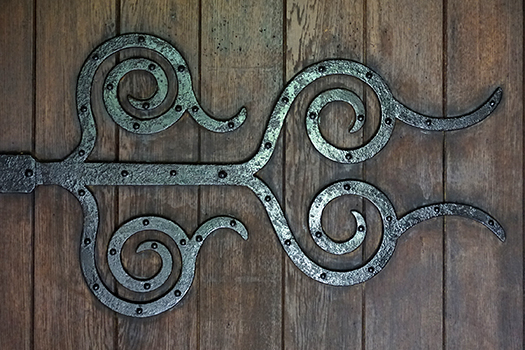
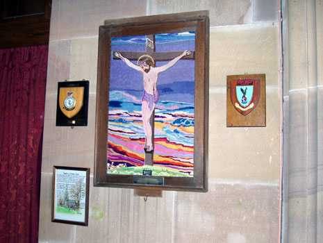
| Church door hinge | Tapestry, RAF plaques and a copy of the poem by Donald McIntyre in 2003 |
|
 |
 |
|
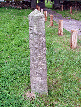
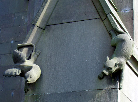
| The Rindle Stone in 2003 | Two of the four animals carved on the buttresses of the church tower |
I first visited Grindon on a rather dull August Bank Holiday Monday in 2003 and looked inside the church. A few days later, I had the opportunity to return in brighter weather to photograph the exterior. There is a small car park by the church and this a convenient starting place for walks to the neighbouring villages, to the Manifold Valley and to Thor's Cave. In June 2018, returning after 15 years with a much more modern camera and was able to replace most of my old pictures with ones of higher quality.
Grindon is mentioned in the Domesday Book as Grendon, meaning a Green Hill. It lies at about 1000 feet above sea level, just west of the Manifold Valley. Grindon was on the pack horse route that took ore from the Ecton Copper Mines to the Churnet Valley and the lime quarries at Cauldon Lowe. The Rindle stone, shown in the picture, is near the main gate of the church and records how the Lord of the Manor of Grindon established his rights to the rindle, a seasonal stream, at the Stafford Assizes in 1862. This is a limestone area and steams frequently run underground but become apparent on the surface in wet weather. The village had an ancient well dressing service, which was abandoned in the early years of the 20th century but was revived in 2003 on the 12th and 13th of July.
The parish church of Grindon is All Saints. There has been a church on this site for almost a thousand years. The first was The Chapel of Ilam, built in the 11th century. The font by the west entrance is Norman and together with two stone coffins it was found when the foundations of the current church were being prepared. A new church was erected in the 16th century; it had a square tower and a school at the east end. The church was destroyed by fire and the current church, built on the same site, was completed in 1848. It was designed by the Francis brothers and has an octagonal broached tower. There are three bells salvaged from the earlier church. They were cast locally. The church also has a plaque on the south wall to commemorate those from the village who died during the Great War. The church clock on the south face of the tower is the War Memorial.
Grindon now forms part of the United Benefice of Calton, Cauldon, Grindon, Waterfall and Blore Ray with Okeover in the Diocese of Lichfield. The parish registers go back to 1697 and are preserved at the Staffordshire County Record Office. The list of incumbents starts in 1307.
The winter of 1946/7 was one of the most severe in the last century. The Staffordshire Moorlands were particularly badly affected and villages were cut off for several weeks. A tragic accident occured on 13 February 1947 when a Handley Page Halifax Bomber from 47 Squadron attempted to drop food supplies. It crashed on Grindon Moor killing the six crew and two press photographers on board. The pilot was Squadron Leader Donald McIntyre. A cairn marking the spot where the aeroplane crashed was unveiled on 28 September 1999. There are memorials in the church to those who died. One is a plaque made from pieces of metal salvaged from the crash site by members of the Pennine Aviation Museum Excavation Team in 1985. The tapestry on the south wall was made by Andrew Barlow of the Leek Embroderer's Guild in memory of those who lost their lives. In addition there is a poem written by the son of the pilot, Grem McIntyre, who was only two at the time of the accident. In recent years it has become the custom of those who live in the village to mark the anniversary of the crash by a service in the church followed by a walk to the cairn.
Since 2003, the tapestry of the crucifiction has been moved to another location as shown in my picture of the nave and south aisle and the aircraft remain are now diplayed with the RAF badges.
Pamphlets available in the church: Well Dressing 2003 and
All Saints' Church, Grindon, The Cathedral of the Moorlands.
The Buildings of England, Staffordshire, by Nikolaus Pevsner, Penguin, 1974,
ISBN 0 14 071046 9
The Old Parish Churches of Staffordshire, by Mike Salter, Folly Publications,
1996.