 |
| No. 1 Lymm Bridge, Grade II listed 18th century canal-side residence |
|
| No. 1 Lymm Bridge, Grade II listed 18th century canal-side residence |
Lymm lies on the Bridgewater Canal only about a mile and a half east of the M6 but has the appearance and feel of a small country town. Its population is about 11,000. A good way to visit, for those sound of wind and limb and who are members of the National Trust, is to park at Dunham Massey, have a coffee there and set out the four miles on the tow path of the Bridgewater Canal to Lymm. There are good places for lunch in the village before returning either by the same route or on a path on the disused railway, accessible just north of the village via Lymmhay Lane. This path forms part of the Trans Pennine Trail on the section running from Warrington to Altrincham.
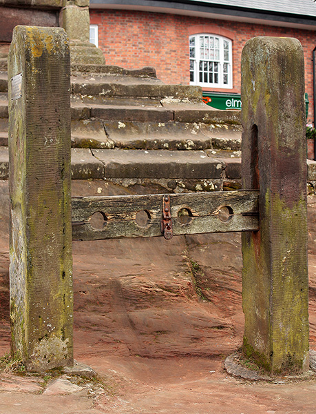
The Grade I listed cross is believed to date from the early or mid-17th century. Pevsner tells us that by the cross is a replica of the stocks. The Bridgewater Canal extension, which brought it through Lymm, was completed in 1776 and stimulated industrial development which included fustian cutting, iron working, quarrying and tanning. The Bradley Brook, just to the south of the town was dammed in 1832-34 to create a lake which is crossed by the A56 at its northern end. From there a footpath runs down The Dingle, a steep wooded gorge, into the main village.
Two of the major historic buildings of the area are not shown here. One is the Grade II* listed Lymm Hall, a private residence, built in the late 16th century with service wings added in the 18th or early 19th century. The other is Outrington Hall, now Lymm High School. It was owned by a branch of the Leigh family as outlined elsewhere on this website. Outrington Hall and the nearby St. Peter's church are east of Lymm, south of the Bridgewater canal at SJ 695 870.
 |
 |
|
| The Cross | Stocks |
 |
 |
|
| Bridgewater Canal route from Dunham Massey | Entering the outskirts of Lymm | |
 |
 |
|
| From Lymm looking down on the canal | Properties by the pool in the town centre | |
 |
 |
|
| Shops opposite the cross in Bridgewater Street | The Spread Eagle |
 |
| St. Mary's, Lymm, April 2010 |
 |
| The Nave, 2010 |
St. Mary's is not a ancient church. It was built between 1850 and 1852 by the architect John Dobson of Newcastle to replace a 14th century church in a state of disrepair. The tower by is by Crowther of Manchester, dating from 1888-1890. The style is mainly early 14th century. The pulpit is Jacobean dated 1623. In a tomb recess from the earlier church of about 1322 is a stone believed to be a Roman Altar as shown below. The East Window dates from 1865.
 |
 |
 |
||
| Possible Roman Altar | East Window | Monument of 1686 |
The King's England, Cheshire, by Arthur Mee, fully revised and edited by E. T. Long, Hodder and Stoughton, 1968.
The Buildings of England, Cheshire, by Nikolaus Pevsner and Edward Hubbard, Yale University Press, 2003, ISBN 0 300 09588 0
Listed Buildings in Lymm
Wikipedia article on Lymm